Geodata solutions powered by radio expertise
Siradel stands out as a unique provider of geographic data, backed by over 30 years of expertise in radio wave propagation and network design. Founded by radio engineering experts, Siradel has expanded its capabilities to specialize in producing map data.
This evolution allows the company to design AI-optimized geographic data products with a sharp radio-focused perspective, delivering unmatched value for simulations in any frequency band (Sub6GHz, mmW or THz) for both operational network design and optimization (4G, 5G, IoT, FWA) and R&D related to B5G/6G technologies and use cases such as V2X, UAV, HAPS…
By using its data in consulting projects, Siradel continuously challenges and improves its products, ensuring they meet the evolving needs of its clients.
AI-Driven Geospatial Innovation
Since 2018, Siradel has been integrating artificial intelligence into its production processes. The models developed rely on discriminative and generative deep learning architectures, designed by the R&D team using the PyTorch library. Their performances are based on the richness and quality of the data produced by Siradel, as well as on advanced training techniques such as active learning and continual learning.
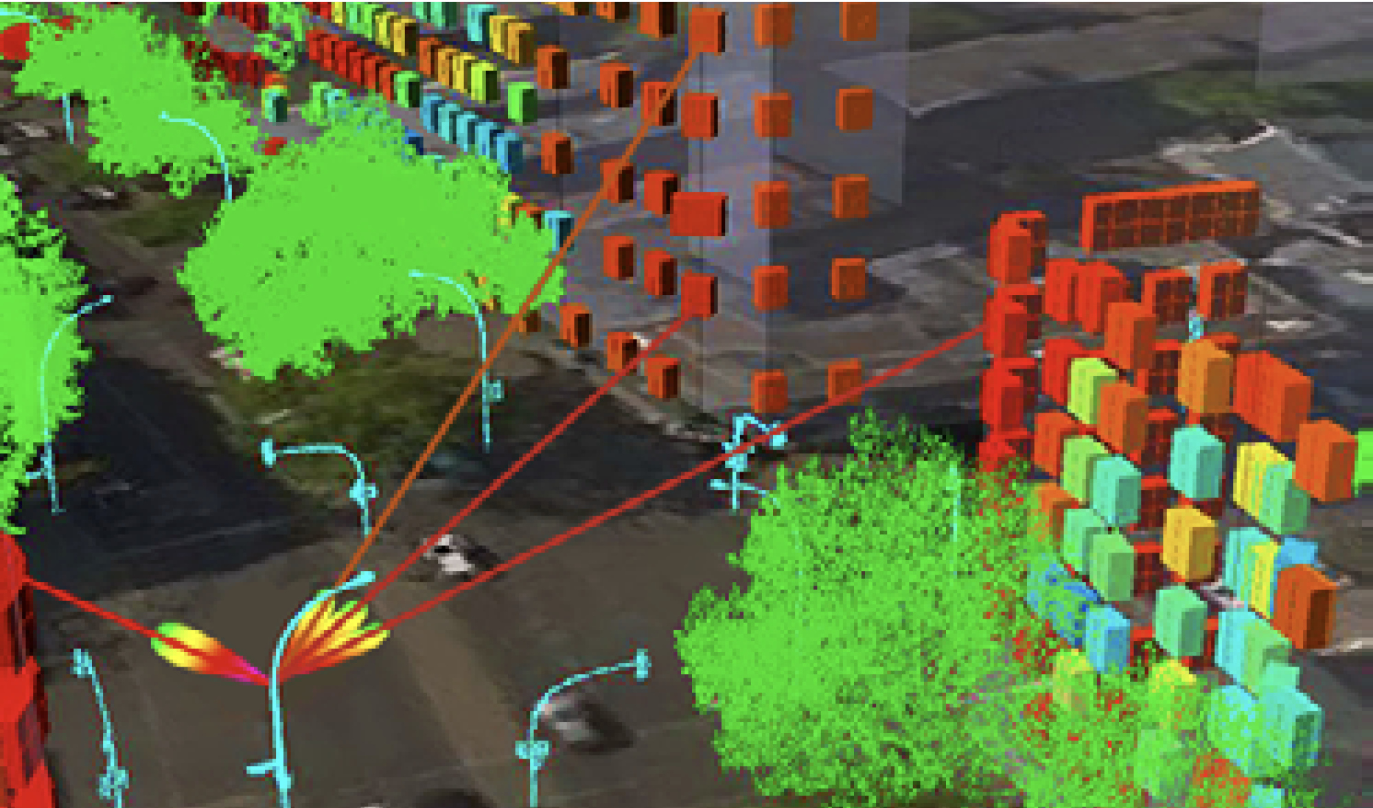
Siradel’s AI models can process a wide range of input data types, including multi-channel aerial or satellite imagery, 3D point clouds, and vector data. They perform various types of computations — detection, classification, regression, filtering, and vectorization — to generate high-quality raster or vector maps.
Siradel offers complete and versatile solutions, tailored to projects of all scales, available in any format (Mapinfo, Shape, DXF, GeoTIFF, BIL…).
By leveraging our extensive portfolio and large-scale production capacity, we facilitate large network deployments, such as 5G and IoT national networks.
From local analysis to large-scale planning, our data empowers you to tackle every challenge with precision and efficiency.
Looking for a telecom digital map?
2D TERRITORY
Essential 2D Geodata
for Telecom
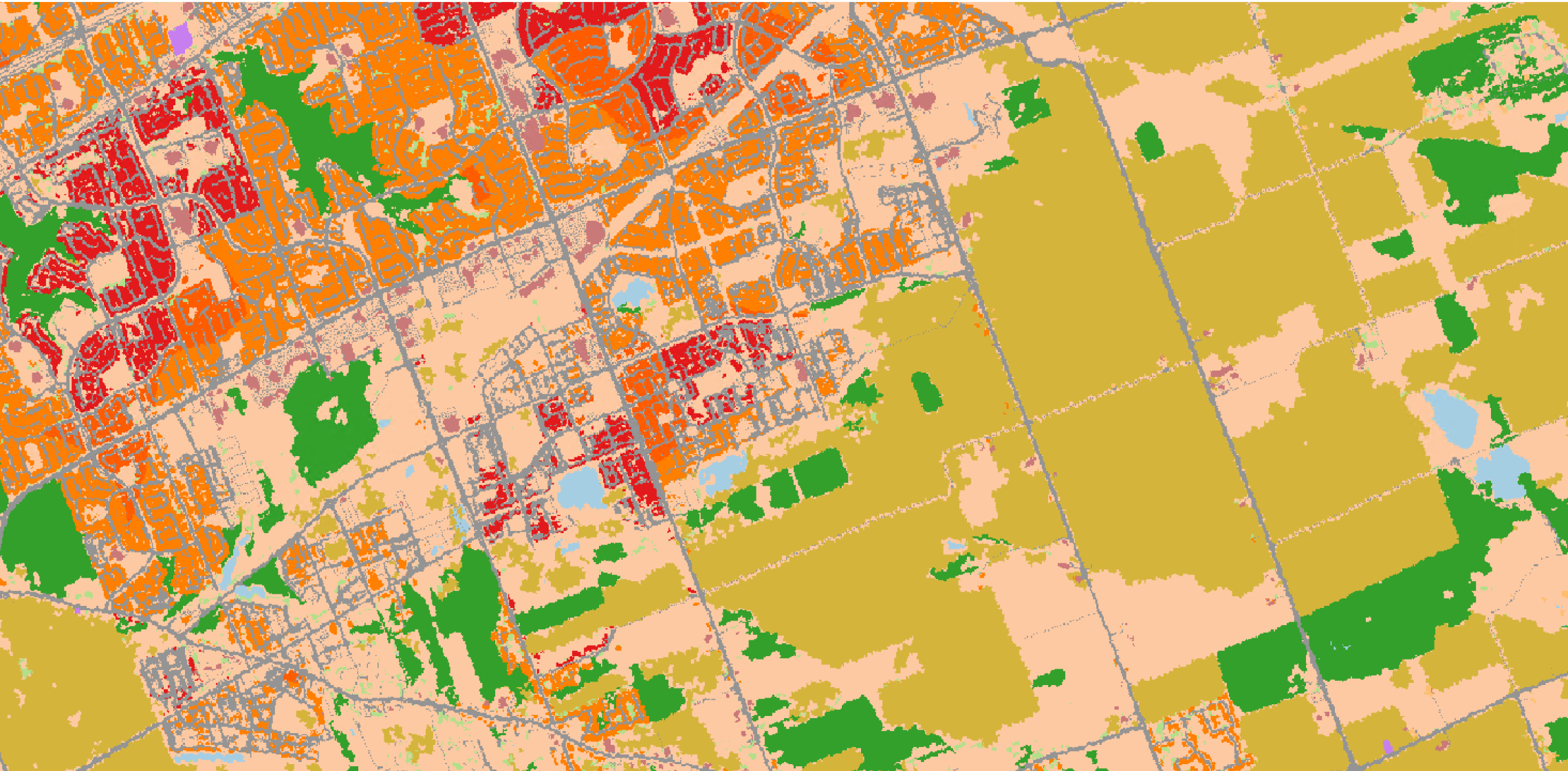
2D Territory medium to low resolution data (10m to 100m) is typically produced over large territories (region or country) and include raster layers such as a digital terrain model (DTM) and digital land use (DLU/clutters), as well as linear vectors.
Typical uses include bid planning, rural planning, publication of nationwide coverage maps and key performance indicators (KPIs)…
3D TERRITORY
State-of-the-Art Solution
for Large-Scale Planning
3D Territory medium to high resolution data (2m to 10m) is typically produced over large territories (region or country) and include 3 raster layers such as a digital terrain model (DTM), digital land use (DLU/clutters) and digital height model (DHM, clutter heights) as well as linear vectors.
It is a unique product on the market, featuring a full 3D LOD2 environment (built-up and vegetation) now accessible in a cost-effective way at a very large scale (e.g., used by mobile operators across the entire French territory, covering over 550,000 km²). Typical uses include: Large scale macrocell planning & optimization, Fighting the digital divide to achieve the latest percentage of coverage, FWA design and CPE eligibility…
3D CITY
3D City Models
for Advanced Network Planning
3D City high resolution data (1m to 5m) is typically produced over very challenging areas (dense urban and urban areas) and include 3 raster layers such as a digital terrain model (DTM), digital land use (DLU/clutters) and digital height model (DHM, clutter heights), 3D polygon vectors, featuring a full 3D environment (built-up and vegetation) enabling the use of advanced ray-based propagation models to consider 3D multipath predictions for better outdoor & indoor planning at large scale.
Typical uses include: City scale HetNet planning & optimization (macro/small/micro-cells), FWA mmW design and CPE eligibility, Site audit and relocation, Wireless channel modeling & digital twin…
3D INDUSTRY
High-Resolution BIM
for Radio Simulation
The 3D Industry product from Siradel offers a highly detailed Building Information Model (BIM) designed specifically for radio simulation. This product is generated at an ultra-high resolution (down to a few centimeters) and follows a Level of Detail 4 (LOD4) standard, providing an accurate and granular view of building structures. It includes detailed internal segmentation, floor by floor, with precise information about material types and properties.
This level of detail allows for comprehensive simulation and analysis, ensuring accurate predictions and optimizations for radio wave propagation within and around complex environments (factory, stadium, railway station, shopping mall…). Whether for private network planning, performance testing, or R&D projects, this product empowers users to make informed decisions based on realistic, high-fidelity data.
3D RAILWAY
3D Models
for Railway Communication Network Design
The 3D Railway product is a specialized adaptation of the 3D Territory model, designed specifically for railway environments. Produced at resolutions ranging from 1m to 5m over a corridor 2x500m wide, it captures the unique characteristics of railway infrastructure with precision.
A standout feature in the market, 3D Railway has been successfully validated through its use in the very first FRMCS network design projects at a national scale (incl. coexistence with GSM-R). Its high-resolution data and railway-specific adaptations make it an indispensable tool for ensuring efficient and accurate network planning in this critical sector.
POPULATION MAP
Demographic data for radio network
design optimization
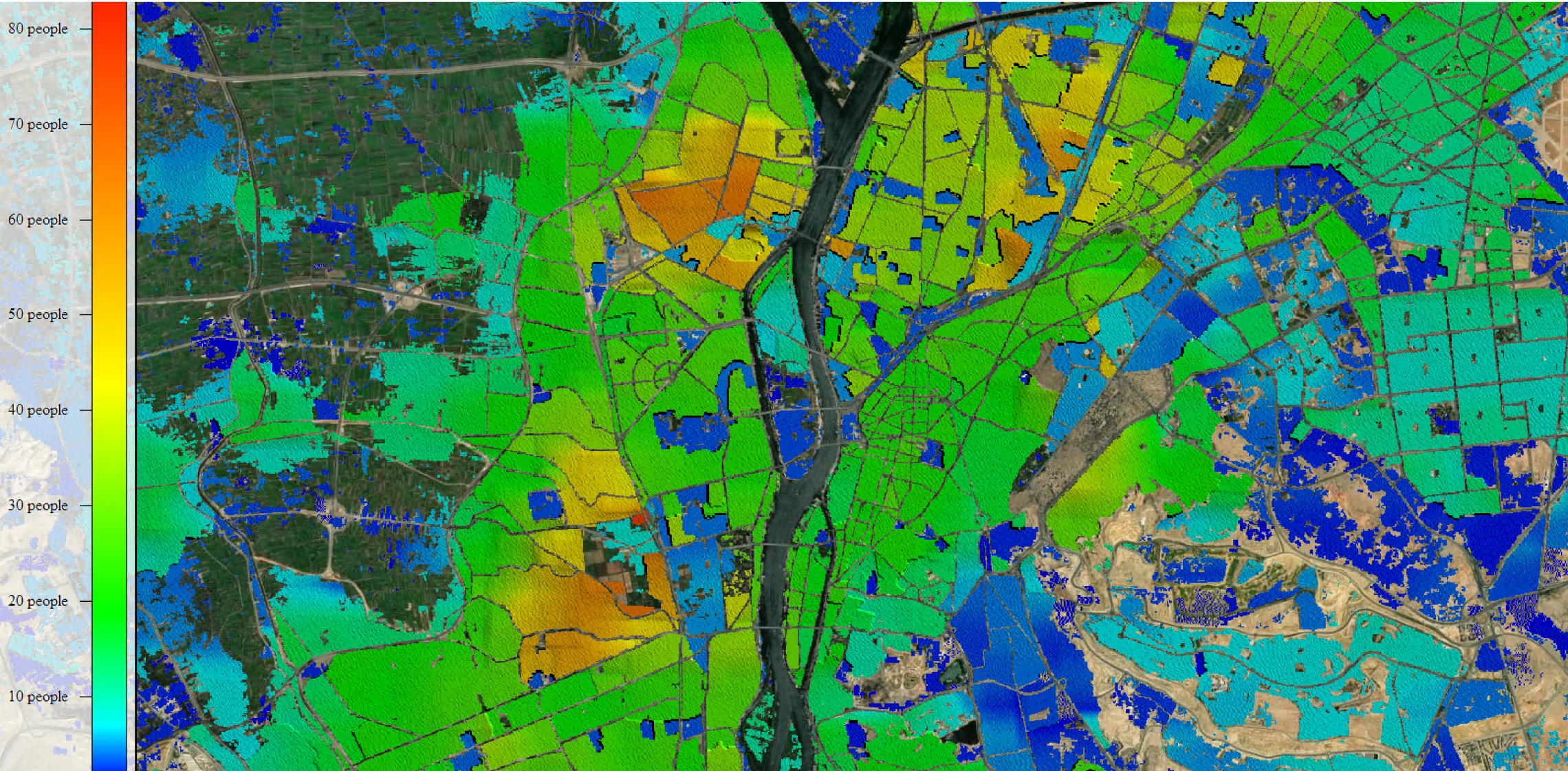
Siradel’s Population Maps offer precise demographic data critical for optimizing radio network design.
By combining population density with land-use classifications, these maps enable efficient resource allocation, improved coverage planning, and tailored connectivity solutions.
Ideal for designing networks that align with real-world needs, Population Maps ensure smarter decision-making and enhanced service quality.
Enhance Coverage and Performance with advanced Telecom Geodata
With strong expertise in radio propagation and a superior, AI-based 3D geodata production process, Siradel provides its customers with high performance products for accurate network design:
- Data accuracy: to provide high levels of details, including vegetation, using the best sources (LiDAR, infra red images, etc.)
- Commitment: to provide high level of confidence in wireless network coverage simulation
- Support: to assist RF engineers in both geodata and RF network design expertise
- Access to a large portfolio: to benefit from Siradel worldwide existing portfolio at very competitive price
- Large scale production capacity: to allow large network deployments, such as 5G, IoT national networks
5G DEPLOYMENTS AND FIXED WIRELESS ACCESS
Siradel InoWave enables R&I telecom teams to stay competitive in the race for new connectivity technologies especially when looking for a telecom digital twin to build simulation scenarios and train/test AI algorithms.
Siradel InoWave RF Digital Twin facilitates testing, validation, and optimization of innovative concepts through heterogenous frequency propagation analysis, channel prediction and network deployment.