Three complementary, data-driven visualization and simulation solutions that help cities anticipate and adapt to climate change.

Cities worldwide are increasingly exposed to climate change risks such as extreme heat and flooding. Building with nature and ensuring equitable access to green and blue spaces helps cities achieve climate resilience to protect communities, city infrastructures, and biodiversity. Many local governments have Climate Action Plans with goals to increase the amount of nature in the city. Our Climate Resilience Toolkit provides powerful visualization and simulation solutions to put these plans into action. The result is a simplified decision-making process for better planning and greater impact.
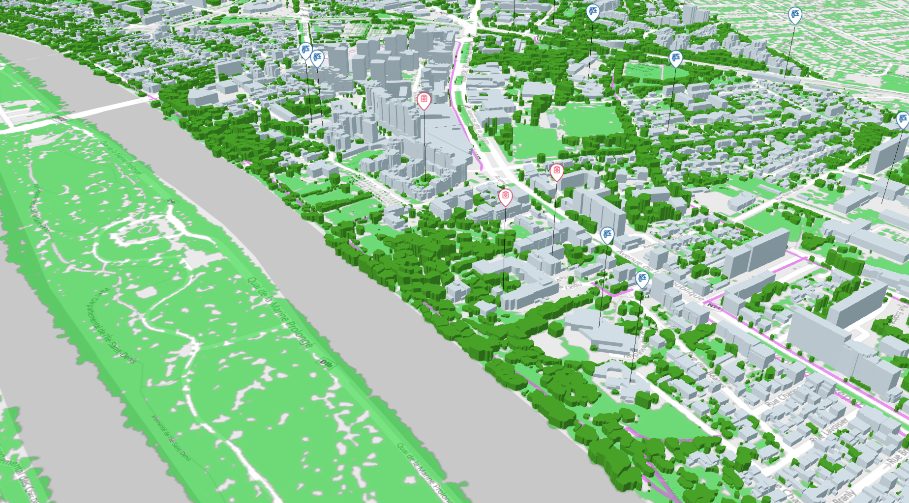
With 28 years of expertise in geodata production, digital twins, and smart city planning, we provide the data plus the visualization and simulation tools to help cities face and reduce the effects of climate change risks.
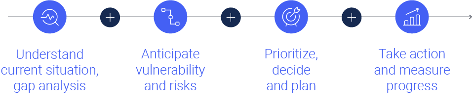
Based on our digital twin and simulation technologies, the three solutions in our Urban Climate Resilience Toolkit help cities achieve climate resilience through four steps :
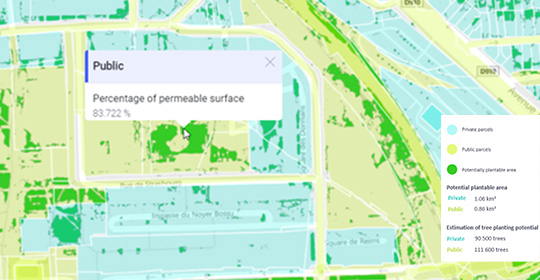
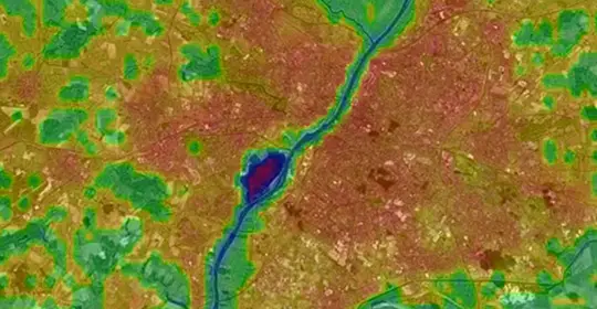
This solution helps transform cities into green cities and sponge cities. By conducting a thorough gap analysis using satellite imagery, AI models, and our digital twins, we help cities better understand current land use and identify areas where nature can be enhanced. We develop personalized KPIs – such as tree canopy index, accessibility to green spaces, ground surface permeability, etc. – and perform simulations to compare the impacts of different greening scenarios on key indicators. The result is a clearer picture of the current situation and better, data-informed decision-making to take measurable action.
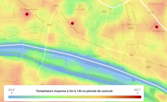
Climate change risks, such as extreme heat, effect certain parts of the city more than others. We analyze your city’s urban form and average ground surface temperature to identify areas prone to the Urban Heat Island effect. By cross-referencing this analysis with additional social and demographic data, we also help determine priority zones where adding more nature will have the biggest impact on thermal comfort. Our digital twin technology helps anticipate and simulate the impacts of greening scenarios on various indicators, such as percentage of population living near heat islands, equitable access to cooling islands, and more.
Anticipate the consequences of global warming in your city by visualizing and simulating different climate change scenarios established by the IPCC. The results help you predict the intensity and frequency of extreme heat events from now until the year 2100. Using the digital twin, we also conduct before/after analysis to measure the impact of proposed redevelopment or greening projects on anticipated temperatures. Understanding the potential climate change risks on your territory means that public policies and urban transformations are planned more proactively and more efficiently.
Our team will be happy to answer your questions and show you some examples of the Urban Climate Resilience Toolkit in action.