At Siradel, we blend geodigital expertise, software engineering, and co-design to turn spatial data into actionable solutions.
From 3D visualization to data integration, our teams create custom tools that bring clarity to your geographic data—helping you make smarter decisions, plan more effectively, and anticipate future challenges.
Whether cloud-based or embedded, our solutions are built with you to shape the next generation of territorial decision-making tools.
From public services to industry, insurance, real estate, and precision agriculture, our geomatics engineers, developers, and project managers design smart, sector-specific digital solutions.
With an agile, collaborative approach, we turn your business needs into powerful digital tools: service platforms (cloud or on-premise), APIs, digital twins, simulations, and more.
We develop in diverse technical environments (Django/Python, C#, C++, Java…) and offer flexible deployment options — whether in the cloud or on your infrastructure. Our custom interfaces and business connectors are tailored to your workflows. To ensure success, we also provide end-to-end support: from installation and training to responsive assistance, so your teams can hit the ground running.
Project Management | Geomatics Expertise | Development in GIS Environments

We design geospatially-driven software that transforms your data into actionable insights — streamlining usage and unlocking strategic value through interactive maps, predictive analytics, collaborative tools, dashboards, and more.
Geodata Valorization | Risk Management | Hypervision | Energy Performance Monitoring

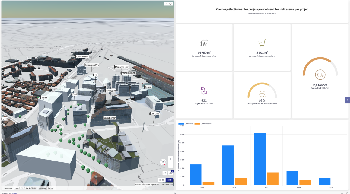
Unlocking the value of territorial data with digital twins.


We design tailored solutions built around your data — ready to integrate seamlessly into your business processes and evolve with your needs.
Our solutions are crafted to support informed decision-making, engage stakeholders, and actively guide transitions. Intuitive and fully customizable, they serve as operational tools that require no advanced GIS expertise to use effectively.
Custom Interfaces | End-to-end Support | Project Scoping | GIS Expertise
Ile-de-France Smart Services Platform
Leveraging our expertise in 3D modeling and mapping, we deliver cutting-edge solutions for spatial analysis, territorial optimization, and management.
Our geospatial services empower local authorities to make the most of geographic data — enabling smarter decision-making, more effective action, and clearer communication.
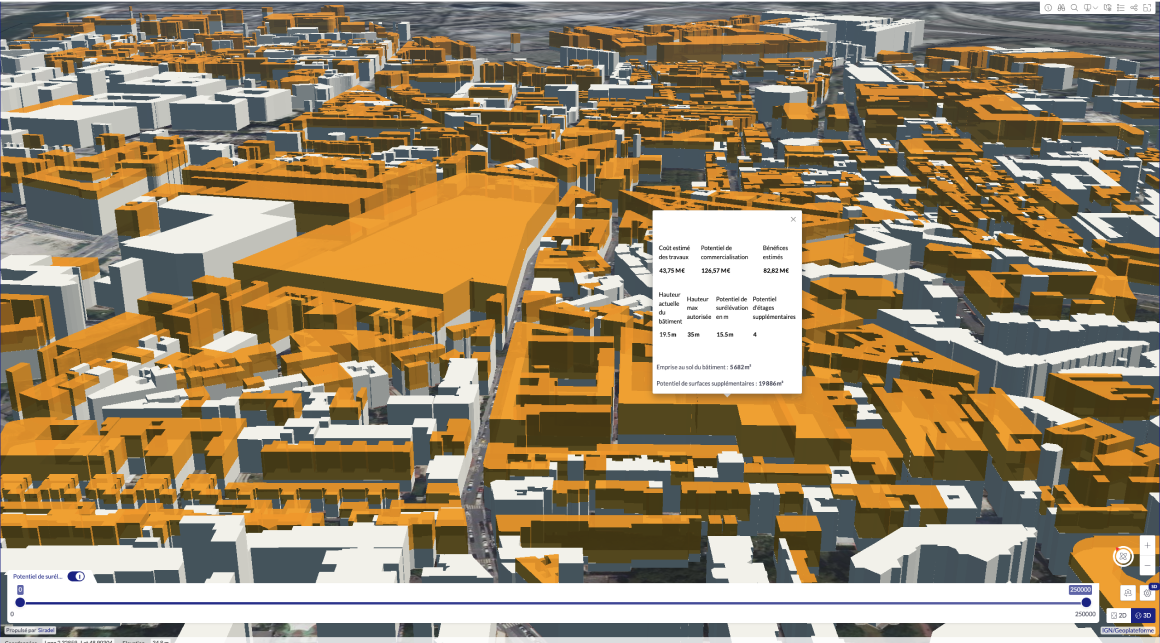
Potential development sites
Assessment of available land reserves for urban densification — including vertical extensions, expansions, and the redevelopment of brownfield sites — in compliance with local regulatory constraints (urban planning documents, strategic guidelines, etc.).