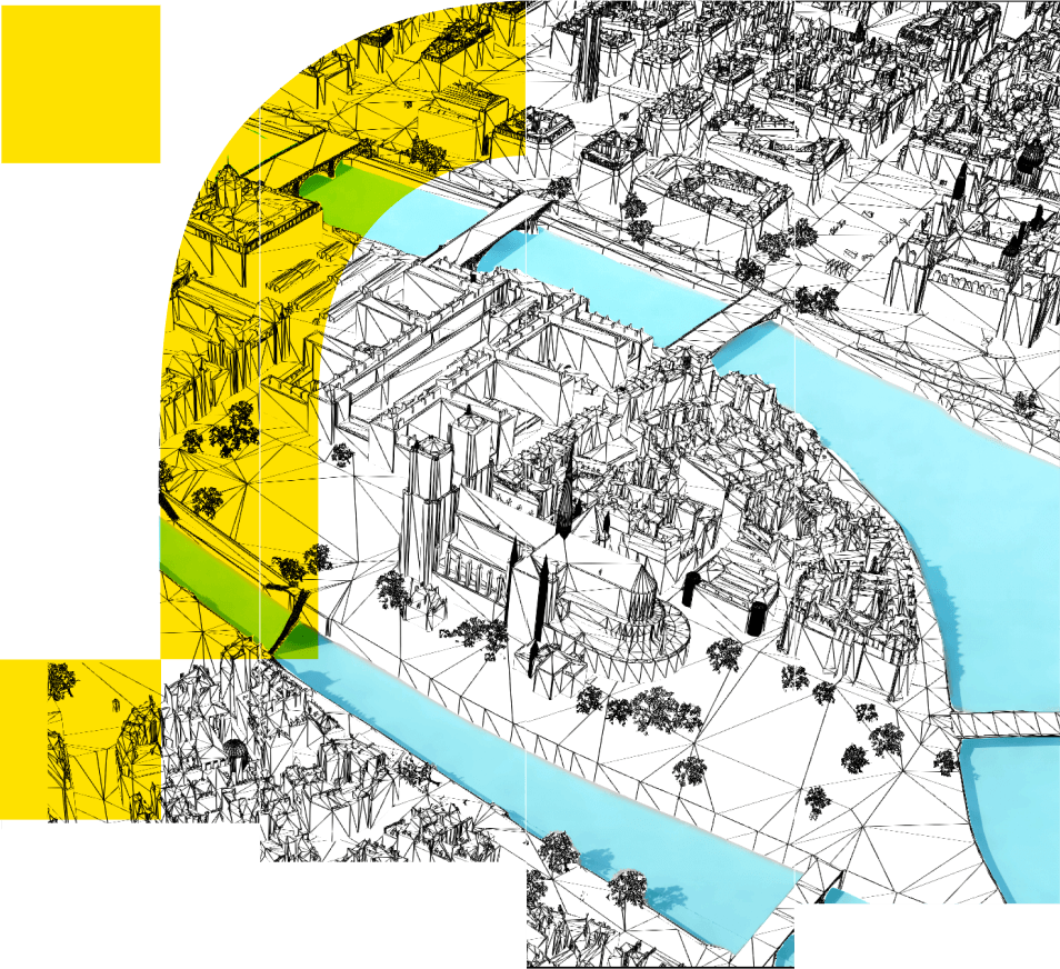
Digital twins, maps, and data-driven insights
While our world is abundant with data, the key lies in unlocking its potential for practical and meaningful use. We produce 3D models, collect geographic data and infuse it all with intelligence and analytics, thereby transforming raw data into actionable insights for positive transformation.
Learn moreWe help telecom professionals, local and national governments, and industry leaders better understand today’s conditions and make more informed decisions about tomorrow’s transformations.
")
We create detailed 3D models at any scale – from individual sites to entire cities and regional geographies – which serve as the foundation for digital twins. We then layer data from satellite imaging, aerial photography, IoT sensors, GIS technology and open data sources for a comprehensive view of the urban environment.
Our data scientists calculate indicators and conduct advanced simulations, combining various sources and formats of data with AI and deep learning algorithms. We identify trends and patterns, uncover potential issues and opportunities in land and infrastructure use, and compare anticipated impacts of different transformation scenarios.
Say “au revoir” to siloed Excel spreadsheets and outdated PDF files. We make data more visually presentable, ensuring it is easy to interpret and share. Our interactive and accessible 2D and 3D maps also promote transparency so you can get the buy-in needed to move forward.

Telecom: Optimizing network design
A detailed understanding of both indoor and outdoor environments allows mobile and wireless network operators strategically plan infrastructure deployments, minimize interference, and enhance coverage and performance.
Discover solutions
Cities: Accelerating urban transformation
Urban planners, mayors, and city managers use our geodata services as decision-making tools to better understand the interconnections of their city’s ecosystem and identify optimal strategies for sustainable development.
Discover solutions
Industry: Empowering decarbonization and resilience
Understanding the physical and geographic aspects of industrial sites empowers managers to monitor energy consumption, reduce emissions, and model environmental and operational vulnerabilities, for enhanced risk management.
Discover solutions
Energy: Enabling a greener energy landscape
3D models of cities and buildings provide the precision needed to analyze rooftop potential for solar panels, track and visualize energy consumption patterns, plan district heating and cooling networks, and ultimately support the shift towards sustainable energy sources.
Discover solutions