Behind every map, every sensor, every satellite image lies an opportunity.
Thanks to our geodata services, this data comes to life and becomes a powerful driver for action.
At Siradel, we turn raw information into operational tools tailored to your challenges: smart mapping, 3D modeling, predictive analytics.
Our expertise: unlocking the value of geodata to give you a clear, actionable view of the terrain—empowering your strategic decisions.

Acquisition, modeling, and processing of geospatial data enhanced with AI for precise and automated analysis

Custom geospatial project development and turnkey cloud solutions

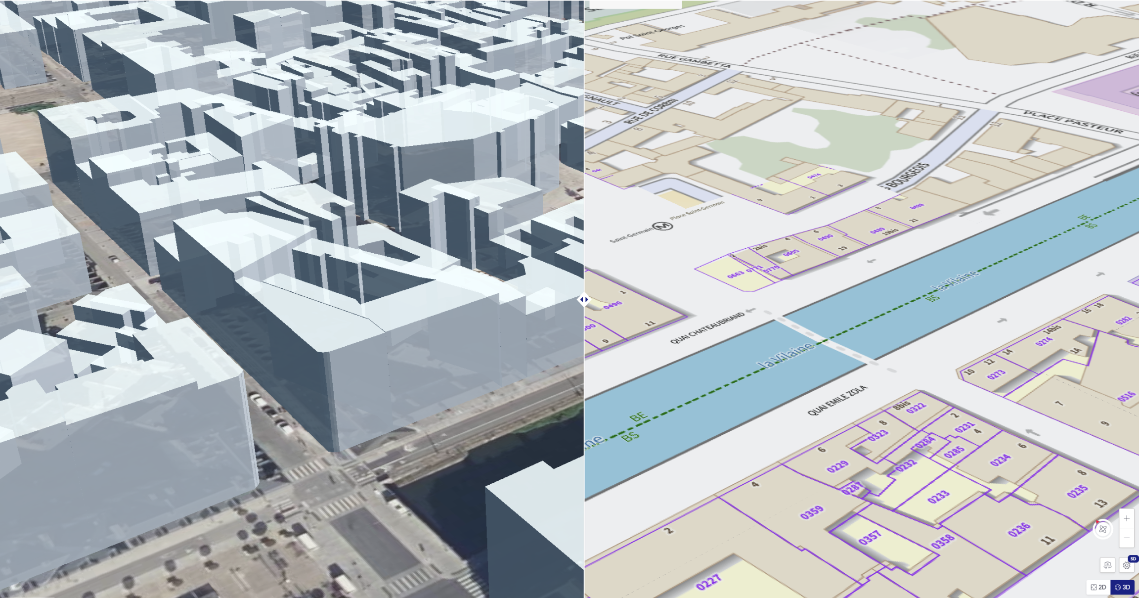
We collect and integrate your 2D and 3D geographic data from a wide range of sources—satellites, drones, field surveys, and more.
Using artificial intelligence and machine learning, we transform this data into actionable insights: automated inventories, semantic classifications, business-specific indicators, and ready-to-use data layers.
The outcome: clear, reliable, and actionable data—designed to support your decisions and drive effective action on the ground.
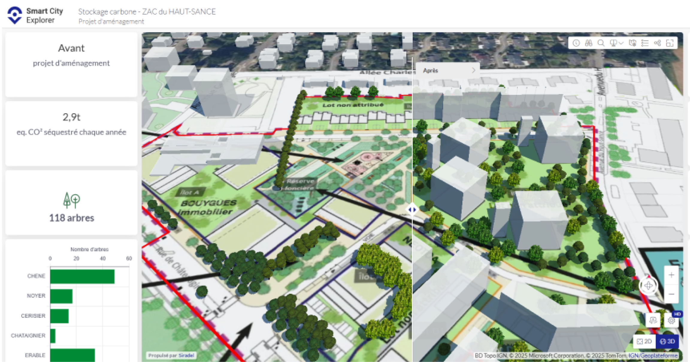
At Siradel, we develop custom engineering solutions and software to unlock the full potential of geospatial data and drive informed, operational decision-making.
From immersive 3D visualizations to advanced scenario simulations, our tools are tailored to meet the unique challenges of sectors such as insurance, precision agriculture, industrial risk management, and climate and urban resilience.
Co-designed with public and private partners, our solutions deliver deep territorial insights. They integrate diverse data sources, model real-world environments, and anticipate outcomes—through intuitive, action-ready interfaces built for decision-makers.
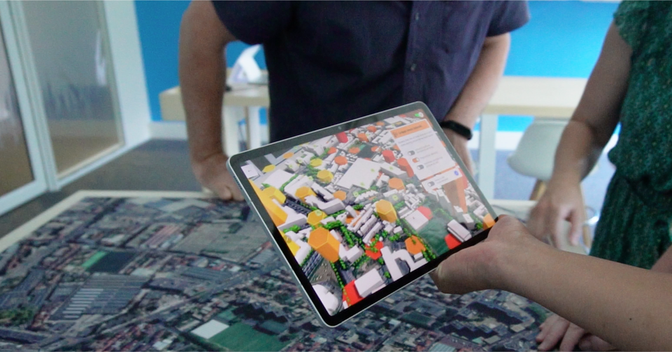
Enhance your projects with immersive and interactive visualizations.
We design innovative solutions—3D videos, virtual tours, augmented reality, touchscreen kiosks, and mobile apps—to turn your data into engaging experiences that inform, convince, and mobilize your stakeholders.

Telecom
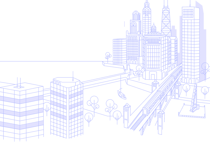
Cities and Regions
Real Estate
Insurance
Industry
Energy
Defence and Security
Agriculture
At Siradel, geointelligence is practical, transparent, and built for immediate action.
Our approach combines innovation, deep expertise, and clear data delivery to turn geographic information into powerful tools for decision support, optimization, and strategic project management.
Exceptional accuracy
Ultra-reliable data and high-resolution simulations
Cutting-edge technology
Since 2018, we have integrated AI at the heart of scalable platforms and immersive tools designed to boost your developments and surpass market standards.
Proven expertise
70 engineers at the service of our clients
Strong values
Simplicity, Usefulness, Proximity, and Responsiveness
A reliable, robust company
A major player in the CAC40 is part of our capital.