Cities are buzzing and constantly evolving at the pace of new technologies, ways of life, asset and infrastructure uses and by necessity. Bringing new challenges, these emerging trends and ongoing multi-sector transformations are also source of a myraid of new opportunities.
In this context, innovation and collaborative projects are focused at finding efficient solutions and developing new methodologies and services to enable these opportunities, which play a major role in territories’ development and smart city initiatives success.
Allowing a comprehensive vision of what a territory is today and of what it could be tomorrow, as well as serving as the base for data visualization, analysis and exploitation, Digital Twins of Cities rise to the top as one of these solutions.
Before exploring their benefits and capabilities, let’s have a definition of what Digital Twins are to better understand their concept and numerous possible uses.
What are Digital Twins of Cities?
The concept of “Digital Twin” first appeared in the industrial world, where its standard definition describe it as a “digital replica of an object, a process or a system that can be used for a variety of purposes”.
Since then, the Digital Twin concept has evolved to become a key aspect in territories’ transformation and decision-making processes. Let’s see how.
Imagine being able to gather, access and visualize all your territory’s data in one single referential?

Imagine having a transversal and integrated vision of all your territory’s characteristics and challenges?

That's what Digital Twins of cities are all about!
No matter what the technology, tool or methodology used as part of their building, Digital Twins of cities are beyond simple “virtual replicas” of a territory.
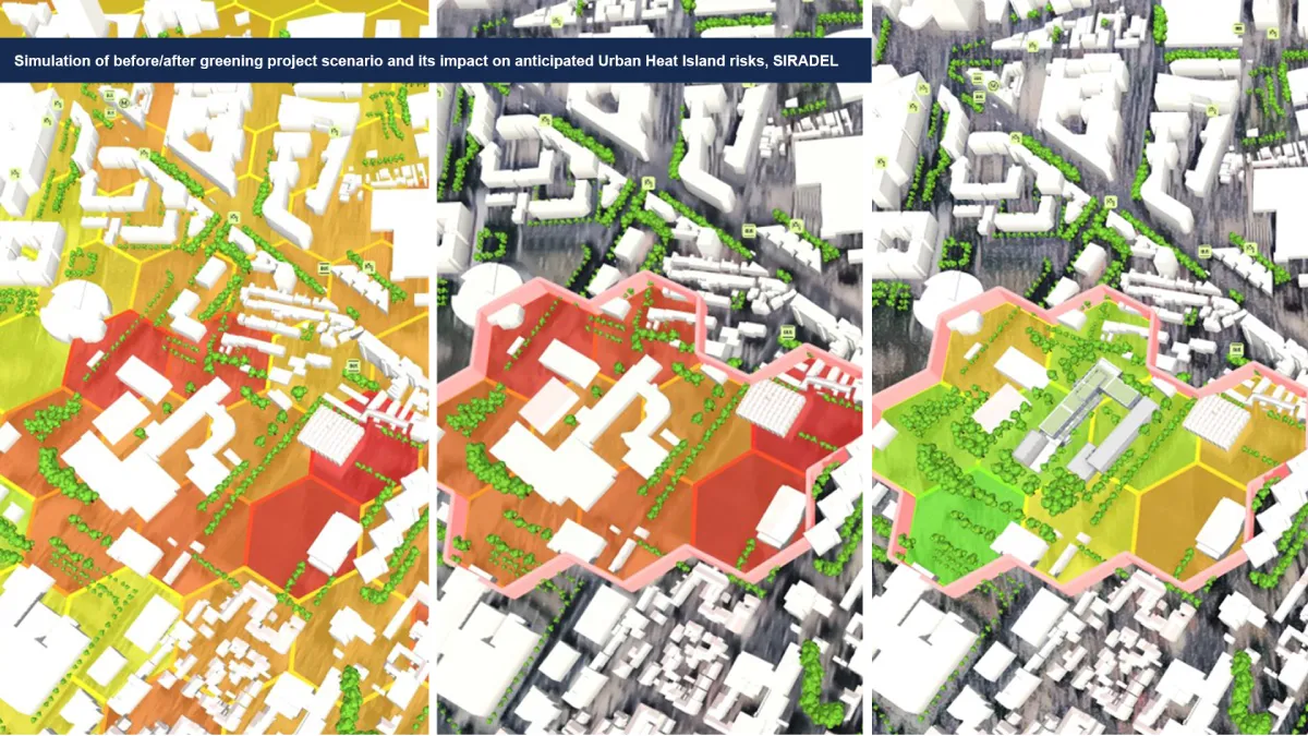
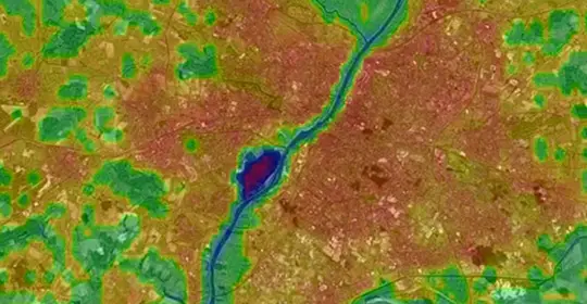
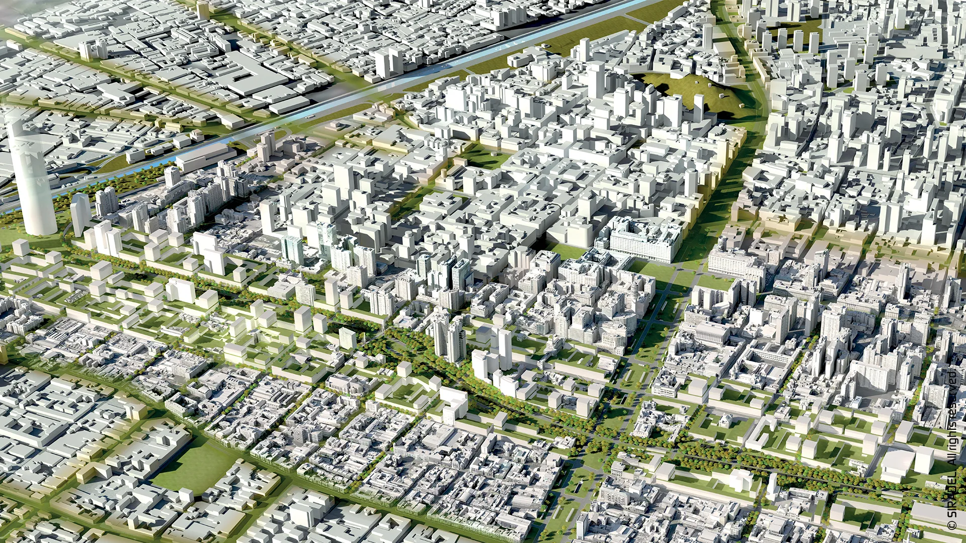
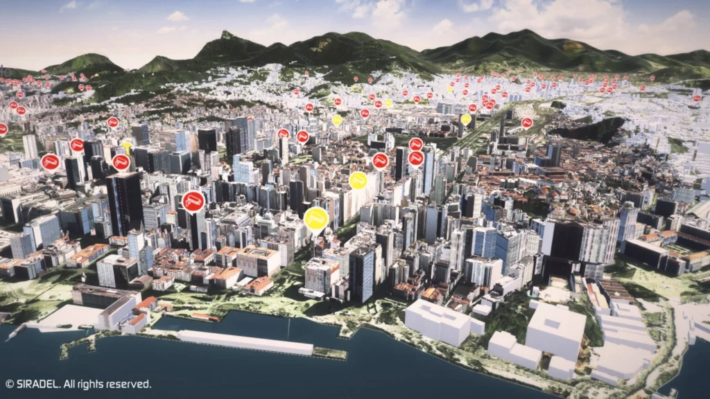
Indeed, in addition to delivering an accurate representation of a district, city, region or even country, they also serve as unique, interactive databases and references, enabling data concentration, cross-correlation, monitoring, assessment, simulation, visualization and sharing of all the city’s information.
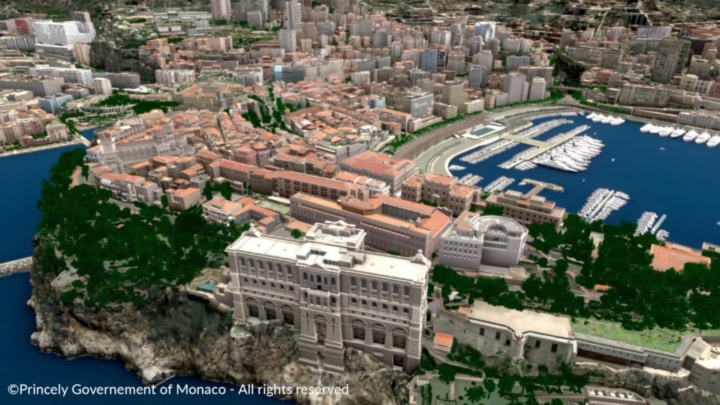
©Princely Government of Monaco – All rights reserved
From environment-related data about pollutant emissions or biodiversity, or energy-related data about buildings consumption or solar cadastre, to data about urban furniture, mobility, security or urban well-being… All this information, collected from multiple sources including open data, private data, real-time sensor data, indicators/results from studies/computations, is aggregated and made available to all of a city’s stakeholders, both public and private, as well as citizens, in a common, transversal referential serving as the basis for the creation of new relevant services relying on data/information exploitation and sharing.
©Siradel – All rights reserved
With this information in hand, local authorities benefit from a comprehensive vision of all their territory’s verticals, thus, allowing a global diagnosis of the territory’s functioning and performances. Delivering such understanding of a territory’s specific assets and challenges, Digital Twins are remarkable decision-making support tools as part of the development of its projects, public policies and smart services offer.
Elements that, in regards to the ongoing environmental, economic and social transitions, make the development and use of such shared referentials essential to support territories in creating and guaranteeing a better environment and quality of life for its citizens, and more generally in solving their challenges.
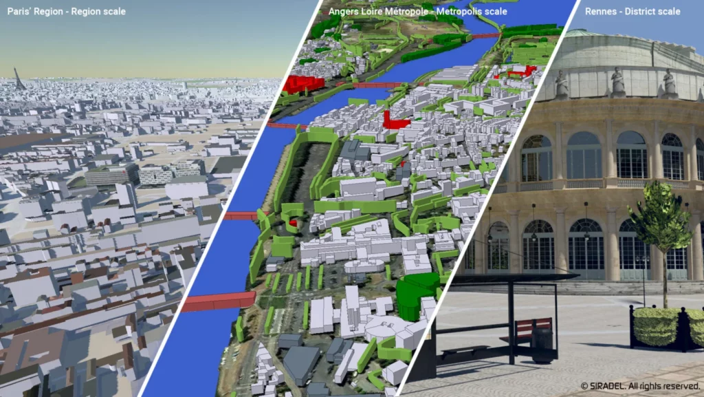
At Siradel, we bring our expertise in data production, modeling and visualization combined with innovative solutions to deliver highly accurate 3D Digital Twins of territories of any size and level of details, for any use or need – for simulation, planning or stakeholders’ communication – to help local authorities, telecoms and industry players around the world address urban transformation, energy efficiency, sustainability and resiliency.
Our exploration of the concept of Digital Twins is not over yet.
Now that we had a first introduction to what Digital Twins are and to some of the possibilities they offer, we propose to dive deeper into their various applications and benefits in our coming article.
If you would like to learn more about how Siradel’s Digital Twins and dedicated Smart City solutions can help assess, decide, plan and optimize territories transformation and development projects, stay tuned and don’t hesitate to contact us!