Previously, we introduced the concept of Digital Twins and provided a first insight of their interest for the building of smarter sustainable territories.
Delivering an inclusive vision of a territory and its components, Digital Twins are, indeed, key elements allowing to better understand its current challenges and strengths as well as its future threats and opportunities.
As rich, up-to-date, interactive databases, Digital Twins offer a myriad of applications and possibilities for smart data exploitation and smart project governance which it is now time to explore more deeply.
PLAN AND DECIDE the future of your territory with advanced simulation
As mentioned before, one of the main assets of Digital Twins is providing an accurate, comprehensive understanding of a territory while aggregating all its information accessible to all via a single repository for a large panel of uses.
But what makes Digital Twins such precious tools, is that combined with simulation capabilities, they become powerful tools to think, design and optimize transformation projects. Indeed:
Imagine being able to assess the impacts of future development projects as well as anticipating risks?

Imagine being able to improve your decision-making process, indicators performance or public policies/services thanks to simulation?

Imagine benefiting from a tool which would give you the possibility to not only imagine the future of your territory but to actually plan it from A to Z?

No need to imagine it anymore! It is now possible with Digital Twins and simulation combined
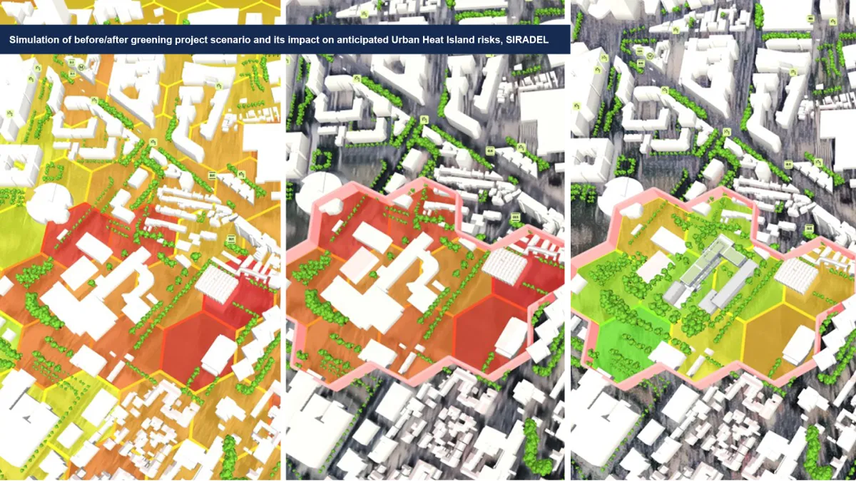
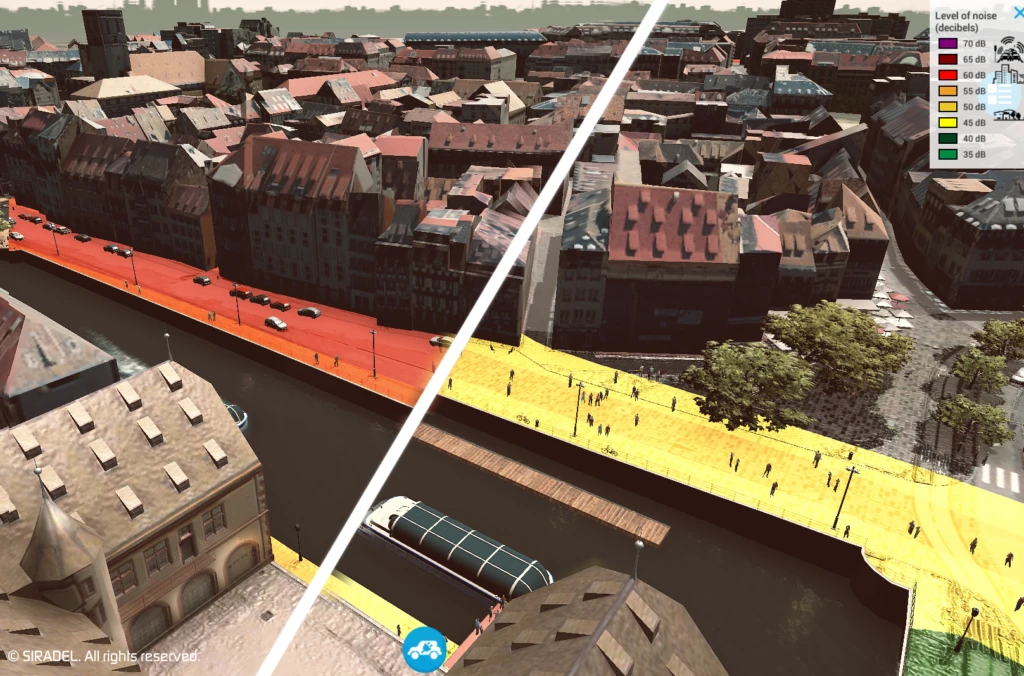
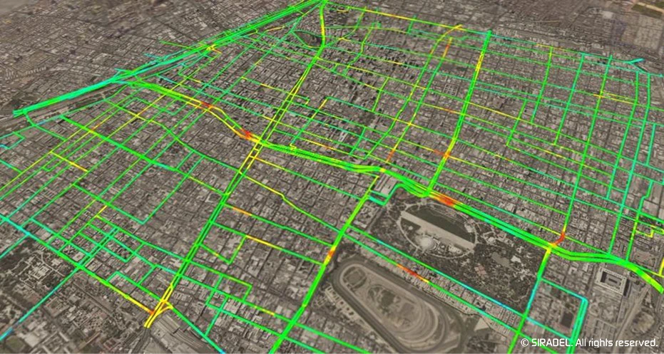
That you would like to anticipate the consequences of roadworks on traffic fluidity, compare the efficiency of two new studied energy programs in terms of energy consumption and costs reduction, evaluate the performance of a future connectivity network or measure the impact of revegetation in certain areas on indicators such as heat islands or urban well-being – ahead of time – Digital Twins and simulation combined is the match that makes it all real!
Given access to such capacities and a multitude of new opportunities, territories are able to predict the possible impacts of any considered transformation and to evaluate different scenarios and their results, when various options are in discussion, in order to make the best decision regarding their objectives and requirements – in terms of cost-effectiveness, resources utilization, « digital sobriety », energy efficiency, risk management/prevention, etc. Thus, supporting them in the driving of their strategies and optimization of their projects.
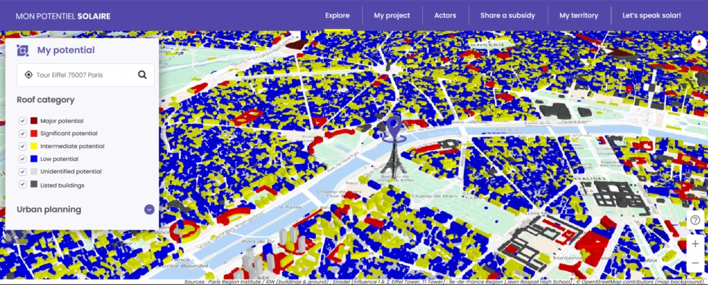
The data collected and newly produced can also be cross correlated to enable the computation of new indicators for a better diagnosis of the territory’s functioning and performances on aspects such as connectivity, economics, well-being, security and much more.
ASSESS AND (BETTER) MANAGE risks for the driving of smarter resiliency initiatives
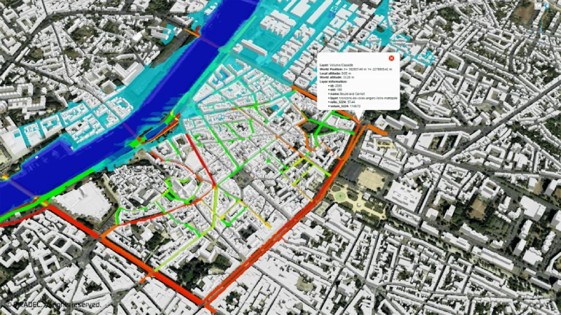
Encompassing advanced predictive simulation capabilities, not only do Digital Twins enable to assess future transformation impacts on a large variety of indicators, they also allow to evaluate and anticipate risks of any nature and source. That it’s for floods, heat-waves, cyber-attacks, or any other natural or man-made threats, Digital Twins allow to predict risks and their consequences to help territories better prevent, react to and rebound from these wide-ranging disasters. Thus, leading to the definition and implementation of smarter, integrated risk management and resiliency policies.
BRING TOGETHER AND INVOLVE all stakeholders for the co-construction of innovative smart services
As unique data-concentrators enabling data visualization, exploitation, enrichment and sharing, Digital Twins also serve as the core platform for the creation of new services destined to the public. Relying on information sharing and resources pooling, they allow to federate and involve every actor including local authorities, economic players, partners, associations, citizens, etc. in the co-construction process. Thus, facilitating the development of collaborative initiatives and digital (services) platforms with the ambition to bring relevant solutions to the city’s challenges and users’ needs across all the territory’s verticals.
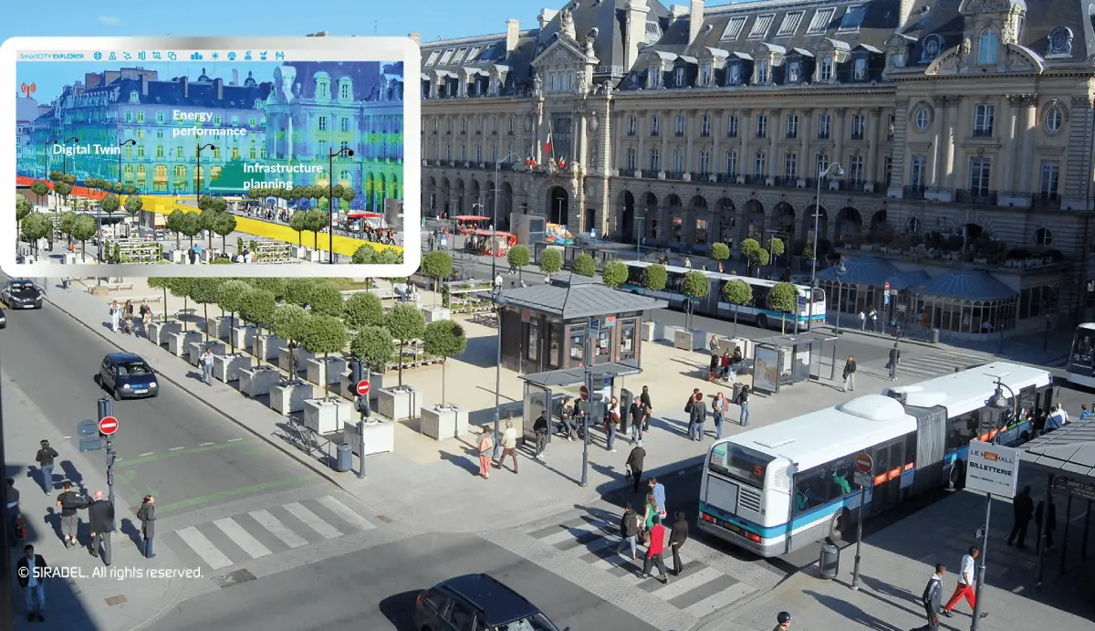
SHARE AND PROMOTE your projects with innovative 3D visualization
Relying on highly-accurate 3D modeling and visualization capabilities, Digital Twins offer a wide range of possibilities in regards to data utilization and display for intelligent, innovative communications. Indeed, providing a realistic representation of a territory with a remarkable level of details and esthetics, Digital Twins also serve as unique communication tools to promote the territory, valorize its data and present its development projects towards all stakeholders from decision-makers to sales/marketing teams or citizens. Thus, offering a solution every step of a project, from planning to sharing.
Giving territories the power to assess transformation impacts beforehand, quickly and efficiently adapt and respond to hazards, promote projects as well as enhancing their data, policies, processes and global offer for public services, Digital Twins are precious decision-making support tools enabling to turn assumptions into something measureable, prospective projects into concrete, successful plans.
From smarter city planning to smarter risk management or communications, Digital Twins are essential to support the evolution of cities’ ecosystems, as complex and changing they may be. Allowing to gather every actor around the territory’s development projects and opening new yet-to-explore perspectives, they are real strategic management tools as part of its Smart City initiatives and operations.
Bringing together our multi-expertise in 3D modeling, visualization, simulation, software platform/applications development and project management, we create comprehensive solutions relying on the Digital Twin of territories and an advanced Smart City platform, to assist territories throughout their entire project, to meet their challenges – in regards to citizens’ quality of life, business development/attractivity, environment, security, smart services availability, etc. – as well as their zero-carbon objectives for the shaping of a more inclusive and resilient future.
Wouldn’t now be the time to explore concrete use cases where Siradel’s Digital Twins haved helped address territories needs and discover their multiple, transversal benefits in a large variety of fields?
To do so, reach us out and write us: contact@siradel.com