Urban Climate Resilience
Extreme weather events such as heatwaves, storms, and flooding – the result of climate change – pose some of the greatest risks to human safety, biodiversity, and city infrastructures. With climate change posing a growing threat to cities, it is important for them to become more resilient. Urban climate resilience refers to the ability of a city, metropole, or region to withstand and mitigate these climate change risks, as well as the ability to adapt to longer-term climate trends such as sea level rise and changing precipitation patterns.
Green Cities and Sponge Cities
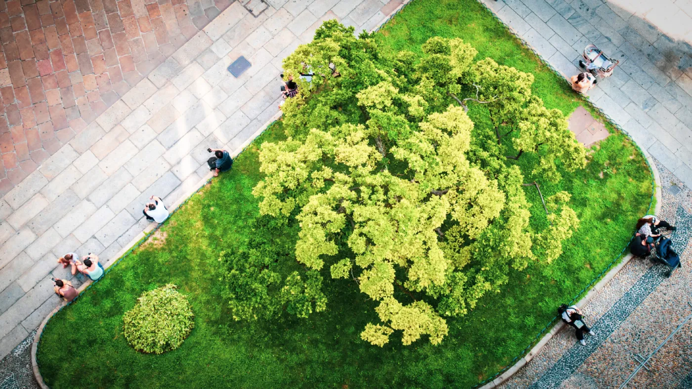
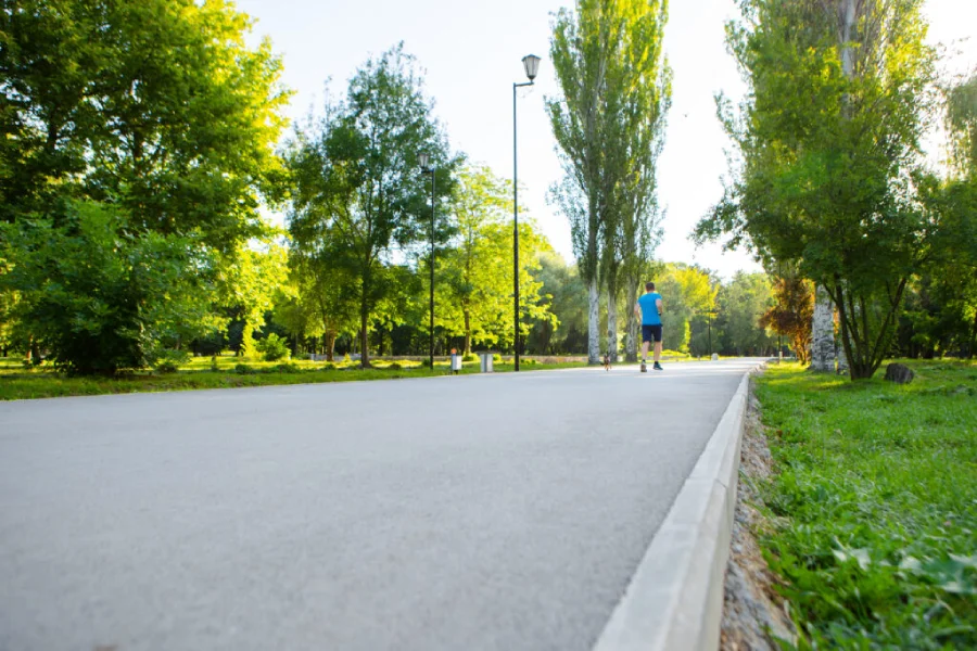
One way in which cities can increase their resilience is by adding more nature to the urban landscape – effectively becoming “green cities” and “sponge cities”. Green spaces such as parks, gardens, and forests can help absorb excess rainwater to prevent flooding while allowing evapotranspiration to lower surface and air temperatures. Trees and other vegetation can also help filter air pollutants, sequester carbon dioxide, provide shade, create habitat for wildlife, and improve overall quality of life.
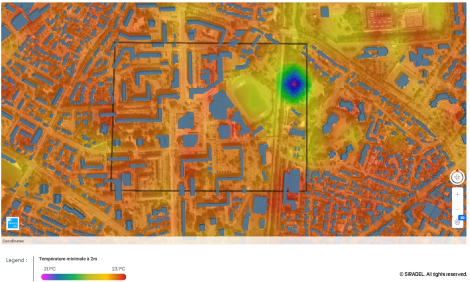
Another way to increase urban climate resilience is by reducing the Urban Heat Island effect, a phenomenon in which urban areas experience higher temperatures than surrounding rural areas due to the prevalence of heat-absorbing materials such as concrete and asphalt. This can lead to higher energy consumption, air pollution, and negative health impacts on residents. The UHI effect can be mitigated using nature-based solutions – such as green roofs and rain gardens – and by making architectural and spatial changes to cities’ built environment – like permeable pavements and reflective rooftops.
Digital twins as a decision-making and planning tool
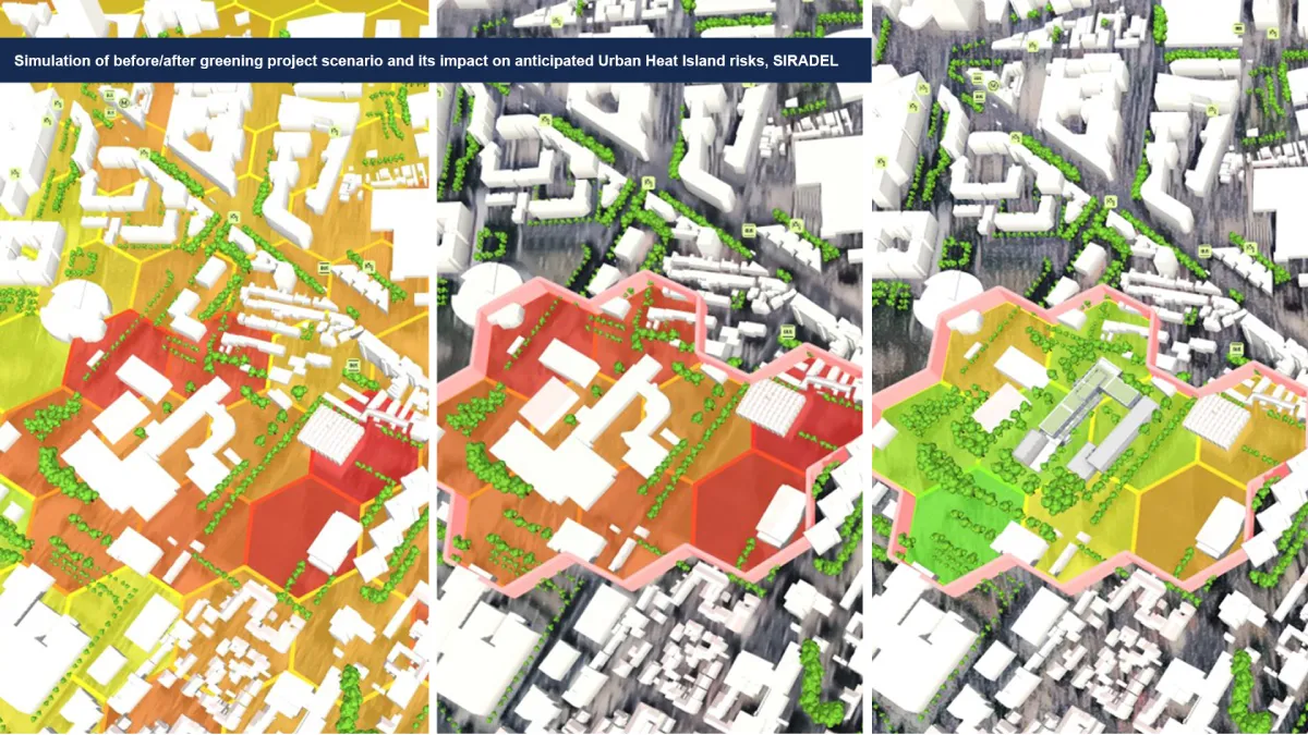
Digital twin and simulation technology helps accelerate urban climate resilience by simulating climate change scenarios, identifying areas prone to the Urban Heat Island effect and high-risk populations, and locating opportunities to incorporate more nature into cities.
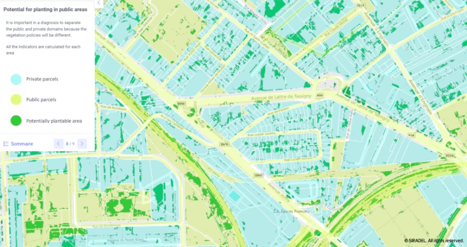
For example, simulations can be used to model the potential cooling effects of adding green roofs, trees, and other vegetation to a city. This can help city leaders make informed decisions about where to prioritize adding more nature and how it can be used most effectively to mitigate heat and excess water.
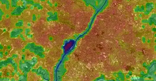
By analyzing data on a city’s built environment, land use, and weather patterns, simulations can also identify which areas are most likely to experience elevated temperatures. Cross-referencing various datasets, such as data about at-risk populations (such as the elderly and young children), provides an additional layer of information that helps city leaders prioritize their efforts and develop data-informed initiatives.
Siradel’s Urban Climate Resilience Toolkit
Using digital twin technology as a foundation, we created an Urban Climate Resilience Toolkit to help cities better anticipate and fight against climate change risks. Delivering advanced simulation and visualization capabilities, therefore allowing to measure custom indicators, simulate impacts of development projets or prioritize greening efforts, our toolkit enables cities to make better decisions as part of their public policies and urban planning strategies.
Click below to learn more about our Urban Climate Resilience Toolkit specially designed to help cities be more efficient on an environment, climate and sustainability perspective or to schedule a demo of the solutions.